Edhitha Unmanned Aerial Systems
Tech Used: Python, OpenCV, Tesseract, Bash, Grep, bash networking tools
Edhitha is an undergraduate student organization of MS Ramaiah Institute of Technology, Bangalore, India. Edhitha develops Unmanned Aerial Systems capable of autonomous flight, object detection, obstacle avoidance, surveillance, mapping, air delivery, and a system which is also capable of real time data transmission. Edhitha harmonizes various fields of Science and Technology to develop an impeccably versatile system capable of civilian applications.
Edhitha participates in the SUAS (Student Unmanned Aerial Systems) competition held by AUVSI in the United States annually. The competition requires Edhitha to design, integrate, report on, and demonstrate a UAS capable of autonomous flight and navigation, remote sensing via onboard payload sensors, and execution of a specific set of tasks.
Edhitha also pitches towards developing an Unmanned Aerial System capable of civilian applications focussing on various fields like Agriculture, law enforcement and rescue operations.
Edhitha is currently ranked among the top 3 Student UAS teams in the country, and has represented Ramaiah Institute of Technology for the last 9 years.
At Edhitha, I was a member of the Computer Vision and Networking team where I worked on:
Autonomous Target Detection and Classification: Used the OpenCV library to build autonomous region proposal and classification pipelines. Used Contour and Background Filtering algorithms like MSER and Canny edge detection to obtain a series of valid Regions of Interest(ROI). Built Shape recognition models to classify regions of interest into one of 7 different geometric shapes. Obtained a validation accuracy of 91 percent using Shape specific, Orientation independent geometric features.
Notifications and Alerts: Built Notification scripts using Bash and Grep to monitor ifconfig dumps and report connection failures.
Wireless Data Migration: Built Shell scripts to migrate image and telemetry data from a remotely connected Odroid C2 to a Linux OS using SSH and RSync
Remote Access and Control: Built bash scripts for remote and autonomous camera control using the GPhoto2 Library and SSH
EXIF metadata mining: Worked on integrating EXIF mining to store and process Temporal and Geospatial Data derived from captured images using exiv2
Client side Data transfer and scripting: Designed a Client side API to send collated JSON files to a remote server using requests and urllib.
Apart from this, I was the co-head of the Sponsorship and Marketing Team, where my job was to identify sources of potential capital, and engage with the same. This would include building partnerships with a majority of our component manufacturers for future sponsorship. I brought in an excess of 1000 USD of capital through revamping our existing GoFundMe story.
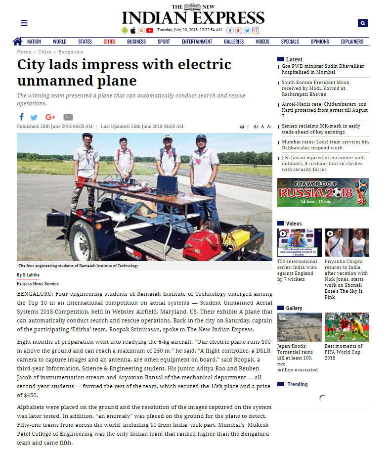
I was part of the 4 man team that represented RIT in 2017, that placed 10th in the world out of 63 teams, that included top 10 and top 20 ranking universities. We were the smallest team at the time to win a place in the top 10.
The team also publishes a paper every year, that details the design and development of the UAS. It can be found at this link